
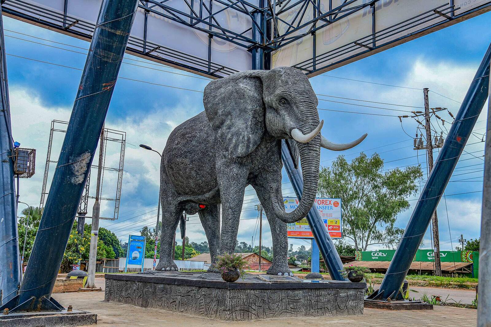
Gulu earns a night rather than a fuel stop, with Fort Patiko, the Acholi cultural institutions and a working city that has rebuilt itself all inside an hour of the main roundabout. Most people arrive on a northern Uganda safari routed towards Murchison Falls or Kidepo Valley. The largest city on the Acholi plateau sits about 333 km up the tarmac from Kampala, on the open Acholi plateau.
Gulu as a Stop on a Northern Uganda Trip
Let us settle the honest question first, because every visitor asks it and almost no guide answers it. Gulu does not have sights in the way Jinja or Fort Portal have sights. There is no waterfall in the middle of town, no crater lake, no famous view. What it has is a city of just over 233,000 residents at the last national census, and the busiest in the north once its daytime population is counted, and the place where every road in the Acholi region eventually meets.
That makes it a good base and a mediocre destination, and the difference matters when you are deciding how long to give it. One night gets you a walk through the market and a decent dinner. Two nights gets you Fort Patiko, a memorial site and a cultural visit, which is the version worth doing.
Gulu became a city in its own right a few years back, taking the administrative weight that used to sit in Kampala for anything happening north of the Nile. Gulu University is here. So is Lacor Hospital, one of the largest mission hospitals in East Africa, out on the Juba road. There is an agricultural research station, a regional referral hospital, banks, supermarkets and a fibre connection that works better than you expect.
The harder part of the story is the one most pages either skip or wrap in soft language. From the late 1980s until the middle of the 2000s, the Lord’s Resistance Army fought a war across the Acholi sub region that emptied the countryside. At its height something close to a million and a half people in the north were living in displacement camps, many of them ringed around Gulu itself. Children walked into town at dusk to sleep in bus parks and hospital verandas because sleeping in the villages meant risking abduction. Nobody who lives here is unaware of it.
The fighting moved out of Uganda in the middle of the 2000s and has not come back. The camps closed. People went home, mostly, and a generation has grown up since who remember none of it. You will see that in the town: the traffic, the boda stages, the students, the new hotels along the Kampala road. You will also see it in the number of organisations still working here, and in the fact that land disputes, which are what happens when a whole population leaves and returns twenty years later, remain the busiest business in the local courts.
None of this is a tourist attraction, and treating it as one is the wrong instinct. It is context you will meet within a day of arriving, and it is better to arrive knowing it.
So, Gulu or somewhere else as your northern base? Gulu, if you want tarmac, a choice of hotels and an airport. Kitgum if you are heading straight for Kidepo and want to shorten the murram section. Lira only if you are coming up the eastern side. For most itineraries linking Murchison Falls with Kidepo, Gulu is the natural break, and it is the only town on that run where you can reliably get a vehicle repaired.
Fort Patiko Historical Tours and the Baker Story
The Fort Patiko tour is the one thing near Gulu that everybody agrees is worth the drive, and it is also the site most likely to disappoint anyone expecting a castle. Set that expectation now. What survives is a low rock plateau, a dry moat cut into the ground, some foundation lines and a set of worn hollows in the granite.
Samuel Baker put a station here in 1872, on a rise the Acholi already knew as Patiko, and used it as a base for the campaign against the slave trade running north towards Khartoum. Before Baker arrived the same rock had been used by Arab and Sudanese traders as a holding point. Guides will show you the grooves worn into the stone and explain what they were for, and they will show you where the executions happened. It is a small place with a heavy history, and the guiding is the whole value of the visit.
Those guides are local, they know the material properly, and they work for whatever the site charges plus a tip. Behind the fort a hill rises another twenty five minutes of climbing, and the view from the top across the plateau is the best thing on the site. Wear something with grip. Nothing is sold at Patiko, no drinks, no food, no shade beyond the trees, so carry water and lunch out from Gulu.
The road out runs north through Patiko trading centre and turns to murram before the end. A saloon car manages it in the dry season. In the rains take something with clearance. Half a day covers the trip comfortably, and most people pair it with Lukodi on the way back, since the two sit on roughly the same side of the city.
Acholi Culture Tours at Ker Kwaro Acholi and the TAKS Centre
An Acholi culture tour in Gulu has two natural anchors, and they pull in opposite directions, which is why doing both works better than doing either.
Ker Kwaro Acholi is the traditional institution of the Acholi chiefs, revived after the war as a body with real weight in local dispute resolution and cultural matters. Its seat is in Gulu, and a small museum of Acholi material culture sits on the grounds: drums, spears, gourds, the regalia of chieftaincy, tools that were ordinary a lifetime ago and are not now. Access is not a turnstile arrangement. Ring ahead or send an operator ahead, because whether anyone is available depends on the day, and if the Paramount Chief is receiving, there are protocols about greeting, seating and what you do with your hands that a guide will brief you on before you walk in.
The TAKS Centre pulls the other way. Through Art Keep Smiling was started by the sculptor David Lukani Odwar in an old colonial clubhouse, on the theory that a town full of people carrying things they could not say out loud needed somewhere to make things. It works as a gallery, a garden, a restaurant and a performance space, and it is one of the few places in Gulu where you can sit for two hours and watch the town’s creative side operate without anyone selling you anything. Bwola, the Acholi royal dance performed in a wide circle with drums slung at the waist, gets danced here, along with larakaraka, the courtship dance with the calabash rattles.
Around both sit the workshops. Gulu has a serious cluster of craft and textile enterprises, most of them started as employment projects for women returning from the camps and now running as businesses: paper bead jewellery, screen printed cotton, leather, woven bags. Several will let you see the workshop rather than just the shop. The Art Factory and a handful of independent studios sell painting and sculpture at prices that will embarrass anyone who has bought African art in a capital city.
Eat Acholi while you are here. Malakwang, a sour hibiscus leaf stew cut with groundnut paste, is the dish the region is known for, usually with sweet potato or millet bread. Boo is cowpea leaves cooked the same way. Odii, a thick simsim and groundnut paste, turns up beside almost everything. Ask for it at the smaller places rather than the hotel restaurants, which default to the same fried chicken and matoke you get anywhere in Uganda.
Gulu City Walking Tours: the Market, the Cathedral and Pece Stadium
Gulu is flat, compact and easy to walk, which makes a Gulu city tour on foot genuinely practical rather than a euphemism for a drive with stops. Give it a morning.
Gulu Main Market is the obvious start and the thing most visitors remember. Produce on one side, smoked fish, dried simsim, secondhand clothes, hardware, tailors working treadle machines under awnings. Prices are quoted honestly more often than not, though foreigners get an optimistic opening number. Bargain politely and briefly.
St Joseph’s Cathedral anchors the Catholic side of a town where the Comboni missionaries arrived early and stayed. Holy Rosary church, closer to the centre, is worth a look for the Italianate front. Between them and the main roundabout stands the peace monument, a sculpture of children with books, put up after the fighting ended and now so ordinary a piece of street furniture that people meet under it without thinking about what it commemorates.
Pece War Memorial Stadium is the other landmark, and the name predates the LRA years by half a century. It was built in the 1950s to honour Acholi soldiers of the King’s African Rifles who served in the Second World War, which is a piece of history the region wears lightly and almost nobody writes down. On a match day it is the loudest place in northern Uganda. The Gulu city marathon uses it as a start and finish, drawing a field from across the region.
Evenings are better here than the town’s reputation suggests. There is a real bar and live music scene, rooftop restaurants along the main roads, and a student population from the university that keeps it going midweek. Nothing runs late by Kampala standards. Boda boda is how you move after dark, agree the fare before you sit down, and ask your hotel which stage they use.
Memorial Site Visits Around Gulu and the Etiquette That Comes With Them
This is the part the ranking guides either leave out or handle badly, so here it is plainly. Yes, the massacre memorial sites around Gulu can be visited. No, they are not museums, and turning up unannounced with a camera is the wrong way to do it.
Lukodi sits about 17 km north of the city. In the middle of the village stands a stone monument topped with a cross, carrying a plaque with the names of the people killed there in the raid of May 2004. Dozens died. The community holds a commemoration each year on the anniversary, and it has built a small documentation space alongside the monument.
What makes a visit to Lukodi worth making is that the people who guide you are the people who were there. Survivors, some of them former abductees, tell what happened on the ground where it happened. That is a different thing from reading a plaque, and it asks something of you in return. Arrange the visit in advance through a Gulu operator, the local council or the school, so that whoever guides you knows you are coming and has agreed to it. Expect to leave a contribution at the end; it goes to the community and it is what keeps the arrangement fair rather than extractive.
Burcoro, west of the city near Awach, marks a separate atrocity from April 1991 with a monument built around the tree where the killings took place. Atiak, on the road north towards the border, marks the massacre of 1995. Both are smaller and less organised than Lukodi, and both are best reached with someone who has been before.
The fuller archive is at Kitgum, about two hours east, where the National Memory and Peace Documentation Centre holds testimony, objects and records from across the conflict. It was set up by the Refugee Law Project with the district, opened in 2011, and it is the closest thing the region has to a formal museum of the war. If you have time for one memorial visit and you want context rather than a graveside, go there instead.
There is a live argument in northern Uganda about whether any of this should be marketed at all. Some local leaders have said openly that building a visitor trade on sites where survivors are still waiting for reparations helps the industry more than the people. Others point out that guiding work and a share of the money are among the few benefits these villages have seen, and that outsiders knowing what happened has value of its own. Both positions are held sincerely by people who lived through it. Going respectfully, arranged in advance, with money left behind, sits on the right side of that line. Going for the frisson does not.
Guruguru Hill Hiking and the Caves at Amuru
Guruguru hiking trips take you into the best piece of history near Gulu that has nothing to do with the recent war. The hill lies out in Amuru district, roughly an hour west, and it is riddled with caves that the Lamogi used as shelter during the rebellion of 1911, when they refused a British order to surrender their guns and were besieged in the rocks for months.
There is no gate, no ticket office and no marked trail. You need a local guide, arranged through a Gulu operator or picked up at the sub county offices, both to find the caves and because clambering about in them alone is a poor idea. The climb is short but scrambly, the rock gets slick after rain, and the views over the Amuru plains at the top are the payoff. Take water and closed shoes.
Further out, and realistically a separate trip rather than a day from Gulu, the far north has proper hill country. Mount Otzi rises to 1,563 m above the Albert Nile near Moyo, with a forest reserve on its flanks. Zoka Forest, over in Adjumani, is the only substantial natural forest left in the region. Agoro Hills, in Lamwo on the Imatong range, give the hardest and best trekking in the Acholi sub region, with a long ascent and a summit looking straight into South Sudan. Agoro sits close enough to the border that you should check the current security position before committing to it, and go with an operator who works there regularly.
Aruu Falls, Hot Springs and Short Trips Out of Gulu
Once Patiko and the memorial sites are done, the day trips from Gulu get more scattered, and honesty helps here: these are pleasant stops on a longer drive rather than destinations in themselves.
Aruu Falls is the pick of them. The Achwa river drops over a set of granite steps in Pader district, off the Gulu to Kitgum axis, into pools with a fringe of forest around them. It is community managed, there is a small charge that goes to the people who look after the site, and the last few kilometres off the main road are rough enough that a vehicle with clearance is the sensible choice in the wet months. Local boda riders run the final stretch for anyone arriving by public transport.
The hot springs at Amuru, roughly 35 km out, are a modest bubbling pool rather than a spa, hot enough to cook an egg in and treated locally as a place with healing properties. Tochi, about 20 km south of the city on the river of the same name, is where Gulu goes at weekends for a swim and a grilled fish. The Atiak forest reserve, up the northern road, holds a resident troop of black and white colobus that you can usually find with a bit of patience.
Karuma Falls is not so much a stop as something you drive over. The Nile shoulders through a run of rapids under the bridge that carries the entire northern highway, and there is a hydroelectric station immediately downstream. Look, do not linger, and do not photograph the bridge or the dam, both of which are treated as security installations.
The Wi Polo shrine at Paimol, out towards Agago and a long half day away, marks where Daudi Okelo and Jildo Irwa, two young Acholi catechists, were killed in 1918. They were beatified, and the shrine draws a large pilgrimage each October. It matters a great deal locally and rewards a visit if the timing lands, and it is a long way to drive if it does not.
Murchison Falls Safaris Through the Northern Gates
A Murchison Falls safari from Gulu is the main reason most visitors are in the north at all, and coming at the park from this direction has a real advantage that guides written from Kampala tend to miss.
Murchison is split by the Victoria Nile. The northern bank is where the game is: the Buligi tracks running out between the Nile and the Albert delta, with Rothschild’s giraffe in numbers you will not see elsewhere in Uganda, elephant, buffalo, Jackson’s hartebeest, Uganda kob and a decent chance of lion in the early morning. Approaching from Masindi in the south means reaching that grassland by ferry across the river at Paraa, which is a fixed timetable and a queue. Coming from Gulu, you are already on the northern side.
The gates that serve the route in from Gulu are Tangi and Wankar, both reached by turning off the Gulu to Pakwach road at Purongo. Chobe and Mubako sit further east near the Karuma bridge and suit anyone driving up from Kampala who wants to enter without going through Masindi at all. From central Gulu, allow two to three hours to a northern gate, and leave early, because the game viewing that justifies the drive happens before nine in the morning.
Inside the park the boat trip upriver to the base of the falls is the fixed point of any itinerary, with hippo, crocodile and a good chance of shoebill on the delta run in the other direction. The top of the falls is reached on foot from a car park on the southern side, so it involves the ferry if you have entered from the north. Park entry is charged per person per twenty four hours, and it is one of the higher rates in Uganda, which the FAQ below covers.
On the way up from Kampala, Ziwa is the obvious break. The rhino tracking site sits beside the highway around 190 km south of Gulu, and tracking white rhino on foot with rangers is the only place in the country you can do it. It works as a stop on the drive north, not as a day trip from Gulu.
Kidepo Valley Trips and the Road East From Gulu
Kidepo Valley trips starting in Gulu need one thing said clearly at the front: this is not a day trip, whatever you have read. Gulu to Kitgum is around two hours. Kitgum to the park gate is another three and a half on murram through the Karenga hills. Five to seven hours each way, before you have driven a single game track, and the road does not reward being rushed.
What that means in practice is an overnight in Kitgum, or a very early start and a night inside the park. Most operators build it as two nights minimum in Kidepo, and they are right to. The park is Uganda’s most remote and the drive is the price of admission.
Fill the tank in Gulu. Fuel gets sparse and unreliable past Kitgum, and the stretch beyond is not where you want to find out. A vehicle with high clearance is not optional in the wet season, and the standard advice from operators who run the route is to travel in daylight only, partly for the road and partly because the north east has intermittent trouble with cattle raiding. Check the current position before you commit rather than relying on anything written a year ago.
If the drive is more than you want, small aircraft serve Kidepo from Entebbe, and Gulu’s own airstrip can be worked into a charter. That is a different budget, and it is covered below.
Getting to Gulu and What the Road North Is Actually Like
Everything published about reaching Gulu quotes five hours from Kampala and stops there, which was fair before the works at Karuma and is worth updating.
The Kampala to Gulu highway runs about 333 km, tarmac the whole way, through Luweero, Nakasongola, Kiryandongo and Oyam. Five to six hours in a private vehicle is realistic if you clear Kampala before seven in the morning. Leave at nine and you can add an hour before you have reached Bombo. It is a busy freight corridor, carrying the traffic between Kampala and Juba, and it has a poor safety record. Overtaking trucks on blind rises is the specific risk. Do not drive it after dark.
Every vehicle on the route crosses the Nile at Karuma. That bridge was closed for a full rehabilitation and traffic was pushed onto long diversions for months, which is where a lot of the alarming travel times online come from. It has since reopened to all traffic, heavy trucks included, and carries street lighting for the first time. Finishing works continue underneath without affecting the crossing. If your information about the northern road is more than a year old, that is the thing that changed.
By bus, the Post Bus is the one experienced travellers pick. It leaves from the main post office in Kampala twice daily, runs to a schedule, stops rarely and is checked before departure. Link, Gaaga and several others work the route with more departures and less predictability. Six to eight hours end to end. In Gulu the bus park sits a couple of blocks east of the main roundabout, walking distance from most of the central hotels.
Gulu Airport lies about 3 km northwest of the centre, handles scheduled domestic flights with a small operator plus charters, and has been through runway and terminal upgrades. Schedules are thin and change, so treat flying as a convenience to check rather than a plan to build around.
Getting around town is boda boda, shared taxi or your own feet. Nothing in the centre is far. For the sites outside the city, hiring a driver with a vehicle for the day is the practical answer, and any hotel will arrange it. The road north from Gulu continues 108 km to Elegu and the South Sudan border at Nimule, which is a working commercial crossing rather than a tourist route, and foreign offices advise against travel into South Sudan itself.
Where to Stay in Gulu and the Best Time for a Northern Trip
Gulu’s hotels are business hotels first and tourist hotels second, which is good news: the standard is higher than the visitor numbers would suggest, because government, aid agencies and traders keep them full.
At the top of the range, Bomah Hotel and Acholi Inn are the long established names, both with pools, gardens and conference rooms, both used for anything official that happens in the north. Churchill Courts sits just below them and is popular for the same reasons. Northern Pearl and Global Friendship cover the middle, and there is a wide spread of small guesthouses around the centre where a clean room with a fan and a bucket of hot water is the arrangement. The TAKS Centre has rooms too, which suits anyone who would rather sleep somewhere with a garden and a gallery than somewhere with a car park.
Book ahead around conference season and around the marathon. Otherwise walking in is usually fine.
On timing, Gulu sits in a hotter, drier belt than southern Uganda. December to February is the dry stretch and the hottest, with afternoons climbing to the low thirties and the countryside brown and dusty. March through May brings the long rains, June to September is drier and more comfortable, and a second wet spell runs through October and November. Rain here arrives as heavy afternoon storms rather than all day grey, and it rarely stops you doing anything in town.
For the sites outside the city the picture changes. Murram roads to Patiko, Guruguru, Aruu and above all Kidepo are much easier in the dry months, and the Murchison game viewing is at its best from December through February when animals concentrate near water. If your trip is built around driving, aim for the dry season. If you are here for the city and the culture, the rains cost you very little. Malaria is present year round, so take the prophylaxis and use repellent in the evenings.
Frequently Asked Questions About Visiting Gulu
Is Gulu safe to visit now?
Yes, and it has been for around two decades. The LRA left Uganda in the middle of the 2000s and the fighting moved into South Sudan, the Central African Republic and the Democratic Republic of Congo. Gulu today has the ordinary urban risks of any Ugandan city, meaning opportunistic theft and bag snatching rather than anything worse, and visitors are not targeted. Foreign offices do not advise against travel to Gulu or the Acholi region. They do flag districts bordering Karamoja in the north east for cattle raiding and armed robbery, and they advise extra care near the South Sudan border, which matters if your route runs to Kidepo or up to Elegu. Night driving on the highway is the genuine risk of a trip here, not crime.
What does it cost to reach Gulu and spend a couple of nights there?
A bus seat from Kampala starts around eight to twelve dollars depending on the operator, and a private vehicle with a driver for the run north is a different order of expense that most people fold into a wider safari quote. Hotel rooms in the town’s main properties run roughly seventy to ninety dollars a night with breakfast, mid range places sit closer to forty, and simple guesthouses come in well under twenty. Entry to Fort Patiko is a nominal few dollars, Aruu Falls charges a similarly small community fee, and a driver with a vehicle for a day of sites outside the city is usually somewhere between fifty and a hundred depending on distance. Rates move, and small community managed sites in particular set their own, so confirm with your operator before you budget.
Can I visit the memorial sites without arranging it first?
You can physically drive to Lukodi and stand at the monument, but that is not really visiting it. The value is in being guided by people who were present, and that has to be set up beforehand through an operator, the local council or the primary school so that someone has agreed to give you their time. It also avoids the situation where a stranger arrives with a camera in a village where the people in it are still living with what happened. If you cannot arrange a guided visit, the documentation centre at Kitgum is the better option and is set up to receive visitors.
How long do I need in Gulu?
Two nights is the answer for most people. One night is a transit stop and you will see the market and not much else. Two gives you a full day for Fort Patiko and a memorial site, and a half day for the city and the cultural venues. Three makes sense if you want Guruguru or Aruu Falls added, or if you are waiting on a cultural visit to be confirmed. Beyond that you are staying in a working city rather than a tourist one, and most people find that is enough.
What are the park entry fees if I carry on to Murchison Falls or Kidepo?
Under the most recently published wildlife authority tariff, a foreign non resident pays around forty five dollars per person per twenty four hours at Murchison Falls and around forty at Kidepo Valley, with lower bands for foreign residents and East African citizens and reduced rates for children. Boat trips, game drives with a ranger and vehicle entry are charged separately on top. The tariff is published in cycles and the authority does not put it out in a form that is easy to check, so treat those figures as the shape of it rather than the last word and confirm with the authority or your operator before you budget.
Can I do Kidepo Valley as a day trip from Gulu?
No. Some pages online suggest it and they are wrong. The drive is five to seven hours each way, most of it on murram past Kitgum, which would leave you no daylight in the park at all and put you on that road after dark in both directions. Kidepo needs a minimum of two nights, with an overnight in Kitgum or Chobe if you want to break the drive. Murchison Falls, by contrast, is genuinely doable as a long day from Gulu if you leave before dawn, though a night inside the park is much better.
What should I pack for a trip to Gulu?
Closed shoes with grip for Patiko and Guruguru, since both involve scrambling on rock. More water than you think, because nothing is sold at the sites outside town. A hat and real sun protection, as the north is hotter and more exposed than the south. Long sleeves and repellent for the evenings. Modest clothing for cultural and memorial visits, which means covered shoulders and knees. Small notes for community fees and contributions, since nowhere outside the city takes a card. A torch, because the electricity goes off routinely.
Is hiring a boda boda for the day a good idea?
Within the city, boda boda is the normal way to get about and works well. For the sites outside it, think harder. Patiko involves a stretch of murram, Lukodi and Guruguru more of it, and riding pillion on a dirt road for an hour each way in the sun is less charming than it sounds. Riders will also want a much higher fare for a full day than the town rate suggests. If there are two of you, a car with a driver costs little more once split and gives you somewhere to keep water and a bag. Wear a helmet if you take a boda and agree the price before you get on.
Do people speak English in Gulu, and is Luganda any use?
English is widely spoken, particularly by anyone under forty, and you will have no trouble in hotels, restaurants or with guides. The first language is Acholi, a Luo language, and it has no relationship to Luganda at all. Trying Luganda in the north lands badly, since it reads as the language of the south being brought north. A greeting in Acholi is worth learning instead. Apwoyo, meaning thank you and also used as hello, will get you a smile everywhere you use it.
When is the best time of year to visit Gulu?
June to September is the most comfortable window, dry enough for the murram roads and cooler than the peak. December to February is also dry and is the strongest period for game viewing at Murchison, but it is hot and dusty in town, with afternoons in the low thirties. The long rains from March to May and the second wet spell around October and November make the roads to Patiko, Guruguru, Aruu and Kidepo harder work, though they barely affect anything you would do inside the city. If your trip is mostly driving, come in the dry. If it is mostly Gulu, come whenever suits.
Uganda Safaris works with Ugandan operators who actually run the north, with drivers who know which gate to use for Murchison from the Gulu side, guides who have standing arrangements at Lukodi and Patiko rather than turning up cold, and vehicles built for the Kitgum road rather than the Kampala one. The road east from here is the one used by trips such as this three day Kidepo wildlife safari through Karamoja.
Browse the wider northern Uganda itineraries on the site, compare what each operator includes, and ask an operator directly for help fitting Gulu into a route that also takes in Murchison Falls or Kidepo Valley.
8 Places to Visit in This Area
Individual sites within reach of here, each with its own guide. Some are written up because the name circulates and the place does not, which is worth knowing before you plan a drive around one.
No operator on the marketplace currently lists a safari to Gulu.
See every Uganda safari