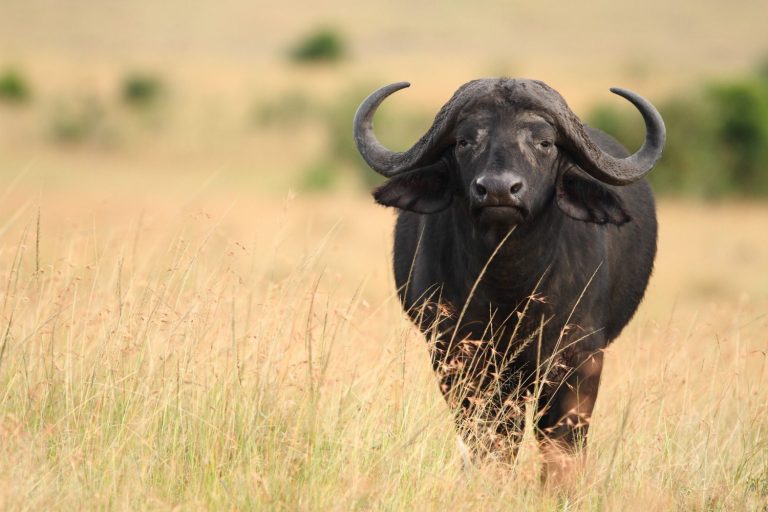
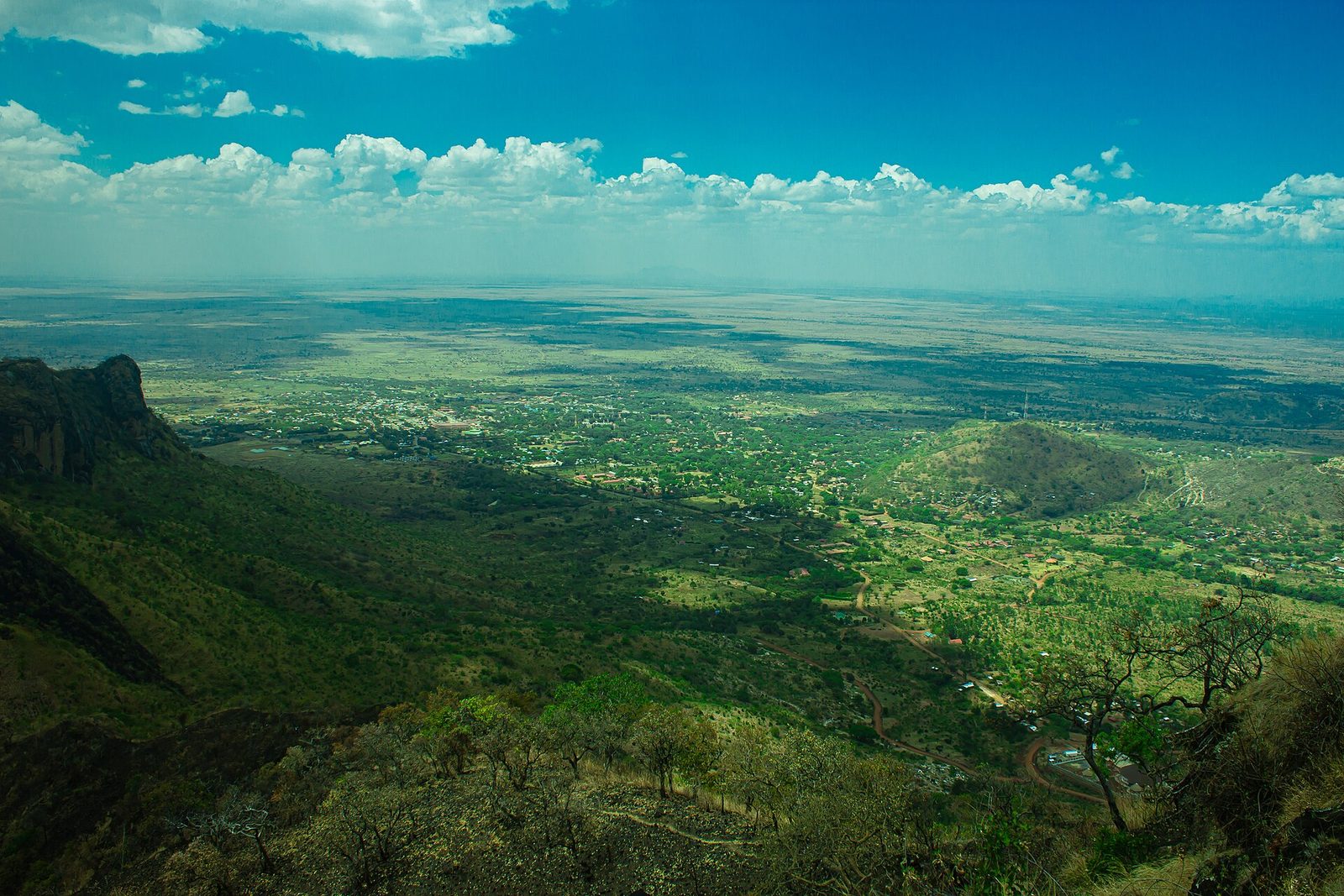
Karamoja is Uganda’s north eastern region, and what draws people is the Karamojong, the volcanic highlands and the long overland route to Kidepo rather than one headline sight. Most visitors come on a guided Karamoja safari of four or five days, usually routed out of Mbale towards Kidepo Valley. Nine districts of semi arid plateau make up the region, bordered by Kenya to the east and South Sudan to the north.
Karamoja Safaris and What This Corner of Uganda Actually Is
Start with the geography, because almost every wrong assumption about Karamoja comes from not knowing where it sits. The region covers roughly 27,500 square kilometres, a little over a tenth of Uganda, spread across nine districts: Moroto, Napak, Nakapiripirit, Nabilatuk, Amudat, Kotido, Abim, Kaabong and Karenga. The last national census counted close to 1.5 million people living in it. That works out at about fifty five people per square kilometre, which is thin by Ugandan standards and the reason the plains feel as open as they do.
It is dry country. Rain comes in one long season rather than the two that southern Uganda gets, running broadly from April into October, and the totals are modest: somewhere between 500 and 700 millimetres a year across the central lowlands, more towards the western edge. Year to year variation is severe. A season can fail. That single fact sits underneath most of what you will see, from the movement of cattle to the state of the roads to the conversations you overhear in Moroto.
What Karamoja is not is a park. There is no gate, no entry ticket, no circuit. A Karamoja safari is a drive through a lived in region with protected areas inside it, and the good days are usually the ones nobody planned: a livestock market in full swing, a herd crossing the road in front of you, an hour spent on a rock with a view of Kenya. Set your expectations for that rather than for a game viewing product and the region delivers.
The rest of Uganda tends to picture Karamoja as somewhere else entirely, and Karamojong people are sharply aware of it. Arriving with that framing intact is the quickest way to have a flat trip.
Meeting the Karamojong: Cattle, Manyattas and Culture Tours Done Well
Cultural tours are the reason most people come, and they are the part of a Karamoja trip most easily done badly. The Karamojong are semi nomadic agro pastoralists, part of the wider Ateker family that also includes the Turkana across the Kenyan border and the Toposa in South Sudan. Within Karamoja the name covers several groups: Matheniko around Moroto, Bokora to the west, Pian in the south, Jie around Kotido, with the Dodoth in Kaabong, the Pokot in Amudat, the Tepeth on the mountains and the Ik on the high ridges near Kidepo. They speak Ngakarimojong, and outside the towns English gets you less far than it does anywhere else in Uganda.
Cattle are the organising fact of life. Wealth, marriage, standing, obligation and much of the social calendar run through them. A homestead, the manyatta, is a ring of thorn fencing enclosing mud and thatch huts and a stock enclosure at the centre, laid out so the animals are inside and everything else is arranged around them. Beadwork, scarification and the heavy patterned blankets are not costume. They are daily dress that carries information about age, status and clan.
Dance is where most organised visits end up, and the Edonga high jumping dance is the one everybody photographs. That is fine as far as it goes. The problem is the visit built entirely around forty minutes of performance for a bus, which leaves the visitor with pictures and the community with very little.
Markets are the honest alternative and cost nothing to arrange. The livestock markets at Kotido and around Moroto run on their own schedule and are the one place where you see the cattle economy working rather than described. Nakapelimoru, a large Jie settlement outside Kotido, is sometimes billed as one of the biggest villages in Africa. Treat that claim lightly. It is worth the drive regardless, as a working settlement rather than a record holder.
Karamoja Security History and What a Trip Here Involves Now
This is the question readers actually have, so here it is plainly, with the awkward parts included.
Karamoja was a closed district under colonial rule, entered only with a permit, and that isolation held long after independence. In the early 1980s, when Amin’s army collapsed, the barracks at Moroto were emptied of weapons and large numbers of automatic rifles went into civilian hands. Cattle raiding, which had existed as a regulated practice between groups, became something else entirely once both sides were armed. Three decades of it followed, with raids running across the Kenyan border and into Teso and Lango, and with the state’s responses frequently as violent as the raiding.
A forced disarmament campaign began in the early 2000s and ran for roughly a decade. By the start of the 2010s the region was quieter than it had been in a generation, and that is the period most travel writing about Karamoja describes. The trouble is that a good deal of that writing was never updated.
Raiding came back. From around the end of the 2010s through to the end of the last full year, the region saw a sustained resurgence: convoys ambushed on the Kotido roads, aid vehicles attacked, government staff in some districts restricted to working a few hours in the middle of the day. Trip reports from that period describe drivers who would take the route but refused to stop on certain stretches, and guides advising against homestead visits. The army ran a second campaign, first with a shoot on sight policy and paid informants, which did real damage to trust inside communities, then from the middle of the decade with voluntary handovers under an amnesty. Something over a thousand firearms were recovered. Raiding has since subsided, and the region is calmer again.
Where that leaves a visitor. The British foreign office names Kaabong, Kotido, Abim, Moroto and Nakapiripirit and advises caution and no night driving, but does not advise against travel there, which is a meaningfully different position from the one it takes on parts of western Uganda. Raiders have not targeted foreign visitors; the risk has always been to cattle owners, to traders and to people on the road after dark. Check your own government’s current wording before you book, because insurance tends to follow it.
In practice that means travelling with an operator who is in the region rather than reading about it, moving between towns in daylight, keeping to the main routes unless your guide says otherwise, and accepting that a plan may change on the morning. None of that is unusual for remote travel. What would be unusual is pretending the last few years did not happen, which most pages about Karamoja still do.
Mount Moroto and Mount Kadam Hiking in the Karamoja Highlands
The eastern edge of the plateau is a chain of old volcanoes, and hiking them is the region’s most underrated draw. Mount Moroto rises to about 3,083 metres directly above Moroto town, close enough that you can be on the trail within half an hour of breakfast. A full ascent is a long day rather than a technical one, roughly ten hours out and back with the walking split by rests, and the upper slopes carry dry montane forest that feels like a different country from the thornbush below. Many people do a half day on the lower trails instead and lose very little.
Mount Kadam, about 3,063 metres, sits south near Nakapiripirit and is better as an overnight, camping on the mountain and finishing the next morning. Mount Napak, roughly 2,538 metres on the western boundary, is shorter but has a steep scrambling section near the top where a fixed rope is used, so it suits people comfortable putting hands on rock.
None of these need technical gear or altitude acclimatisation, which is what makes the Karamoja mountain treks a sensible alternative to the Rwenzori for anyone who wants a summit without a week of commitment. Guides come through the guides office in Moroto or through your operator. Take far more water than you think, since there is none on the ridges, and start early, because the afternoon heat on exposed rock is the thing that defeats people rather than the gradient. The Tepeth live on Moroto and Kadam and were on these mountains before the Karamojong arrived on the plains, so a hike here is usually a cultural walk as well whether or not it is sold as one.
Trekking Mount Morungole and the Ik Story People Get Wrong
Mount Morungole, about 2,749 metres, stands on the northern edge of the region against the Kidepo boundary, and the Morungole trek is usually arranged from inside Kidepo Valley National Park rather than from the Karamoja side. It is a long walk on reasonable ground, eight hours and upwards depending on pace, ending in the villages of the Ik.
The Ik are worth knowing about properly, because almost everything written about them repeats a story that has been taken apart. An American anthropologist spent time with them in the middle of the 1960s and published a book in the early 1970s describing a society that had abandoned kindness entirely, refusing to feed its own elderly and children. It was widely read and it made the Ik famous as an example of what scarcity does to people.
Later researchers went back and found something close to the opposite: ordinary reciprocity, sharing and generosity, at levels comparable to anywhere else. What the original account had recorded, it now seems, was a community in the middle of a severe famine, having recently lost access to its hunting and foraging grounds when Kidepo was gazetted as a national park. A snapshot of people at their worst moment was published as their permanent character, and it stuck for forty years.
Go, by all means. The walk is good and the ridge top views over into South Sudan are the best in the region. Just go without the book in your head, and be aware that the Ik are a small community receiving a growing number of visitors, which brings its own pressures.
Kidepo Valley Safaris and Where Karamoja Fits Around Them
Kidepo sits in the far north of Karamoja and is the region’s principal draw by a wide margin. It holds Uganda’s only wild ostrich, the country’s only resident cheetah, and species such as greater kudu and caracal that turn up nowhere else in Uganda. Our full guide to Kidepo Valley National Park covers the game drives, the Narus and Kidepo valleys, the hot springs and the lodges in detail, so this page will not repeat them.
The point worth making here is the relationship between the two. Most visitors to Kidepo fly in from Entebbe, land at Apoka, spend three nights inside the park and fly out, and see no Karamoja at all. That is a perfectly good trip and it is the right one if time is short. What it misses is the region the park sits in, which is the part that surprises people.
Driving in takes two days rather than ninety minutes and turns a park visit into a regional one. You pass through the reserves, sleep in Moroto, cross the Jie and Dodoth districts and arrive at Kidepo having already spent time in the country the animals move through. The trade is real: a fly in buys you two extra days in the park, an overland route buys you the region. Deciding which you want is the single most useful planning decision for a Karamoja trip, and it is better made early, because the flights run on limited days and fill.
Pian Upe, Bokora and Matheniko Reserve Tours Across the Plains
Three wildlife reserves cover a large block of central and southern Karamoja and are the part of the region almost nobody visits. Together they form a connected system rather than three separate destinations, with animals moving between them along the corridor that gives one of them its name.
Be honest with yourself about what reserve tours in Karamoja deliver. Wildlife numbers in the three reserves are far below what a park visitor expects, tracks are rough and sometimes barely there, and you may drive for an hour seeing cattle and nothing else. What you get instead is emptiness, kopjes, hills that nobody has photographed, and the strong likelihood of having the whole thing to yourself. Fair terms if you know them in advance.
Birding Safaris Through the Karamoja Dry Country
For birders the region is a dry country list that is hard to build anywhere else in Uganda, and a serious birding safari here can add species that a standard southern circuit never offers. The headline bird is the Karamoja Apalis, a small warbler restricted to whistling thorn country in the north east, which is the single strongest reason for an East African lister to make the drive.
Alongside it: Jackson’s Hornbill, Hartlaub’s Bustard, white headed buffalo weaver, Abyssinian ground hornbill, Abyssinian roller, secretary bird, pygmy falcon and ostrich. Pian Upe carries the reputation and holds several hundred recorded species; Bokora’s swamps are better than the drive in suggests; Kidepo’s list runs to the high hundreds once its raptors are counted.
Timing is the opposite of what game viewing wants. The wet months from April onwards bring breeding plumage, migrants and green cover, which is when the birding is at its best and when the roads are at their worst. Birders mostly decide that trade in the birds’ favour, hire a 4×4 with a driver who will not panic at a wet murram surface, and accept losing a day.
Moroto Town, Napak Rock Art and Short Tours Out of the Base
Moroto is where a Karamoja trip is run from. It is a small, hot town under a large mountain, with a guides office on the main street, a handful of hotels, fuel, a bank and a market, and it works as a base far better than it works as a sight. Give it an afternoon and a mountain morning and you have used it properly.
Out of town, several short tours fill a spare day. Rock art sites around Napak and in the hills near Moroto carry painted and engraved panels of uncertain age, and the better known Nyero panels sit further south in Teso on the way in. Gold is dug by hand across a belt running through Matheniko and Amudat, and one operator runs a visit to working artisanal sites, which is the most unusual half day available in Karamoja and a blunt lesson in what the region’s mineral wealth actually means for the people digging it. Bicycle and motorbike tours have become the regional specialty, and on quiet murram between homesteads they are genuinely the best way to move, with the obvious caveat about heat and distance.
Community run camps have opened in several districts, and staying at one for a night does more for the money than any organised village visit will. They are simple. Bucket showers, no generator past nine, food cooked over fire.
Getting to Karamoja and the Roads That Take You There
The standard route runs Kampala to Jinja to Mbale, then north east into the region, and it has got substantially easier in the last few years as tarmac has pushed further in. Mbale to the Pian Upe area is now largely surfaced and takes about two hours, where it used to take four. From there Moroto is another two hours, Kotido about two beyond that, and Kidepo three to four hours further on murram through Kaabong.
| Leg | Time | Surface |
|---|---|---|
| Kampala to Mbale | 4 to 5 hours | Tarmac |
| Mbale to Pian Upe | 2 hours | Tarmac |
| Pian Upe to Moroto | 2 hours | Mostly tarmac |
| Moroto to Kotido | 2 hours | Murram |
| Kotido to Kidepo | 3 to 4 hours | Murram |
| Gulu to Kidepo | 4 to 5 hours | Mixed |
Two things the table cannot show. Average speed on the murram sections rarely gets above fifty kilometres an hour even when the surface is dry, so plan by hours rather than by distance. And fuel is dependable only as far as Mbale. Beyond it, fill at Namalu, Moroto or Kotido whenever you pass a working pump, and fill again at Kaabong before the Kidepo run, because there is nothing after it.
A 4×4 with decent clearance is the only sensible vehicle. Self driving is possible and people do it, but the case for a local driver is stronger here than anywhere else in Uganda: they know which stretch is washed out this week, where the fuel actually is, and what the security picture looks like today rather than last season. The other common route comes down from the west, entering through Gulu and Kitgum, which is the quickest way to Kidepo by road and the one that skips Karamoja almost entirely. Flying to Kidepo’s Apoka airstrip from Entebbe takes a little over an hour and runs on set days with a minimum passenger count, so it needs booking well ahead.
Where to Stay in Karamoja and the Best Time for a Karamoja Trip
Accommodation is thin and concentrated. Moroto has the most: a couple of proper hotels, a tented safari camp at the foot of the mountain that doubles as the region’s main visitor hub, and several small guesthouses in town. Kotido and Kaabong have basic guesthouses and little else. Pian Upe has a tented camp at the headquarters plus wildlife authority bandas and a campsite. Kidepo has the full range, from a high end lodge inside the park to the wildlife authority rest camp at Apoka. Many Moroto properties are not listed on booking sites at all, so your operator or a phone call does more than a search will.
Four to five days is the realistic minimum for the region on its own, and six to seven if Kidepo is part of it. Anything shorter turns into driving. The Karamoja Cultural Festival, now past its tenth edition, runs for most of a week in early September and moves between districts, most often returning to Moroto. It brings together Ateker communities from Uganda, Kenya, South Sudan and Ethiopia, and it is the one week of the year when the region is genuinely busy, so book beds early if you plan around it.
Frequently Asked Questions About Karamoja Safaris
Is Karamoja safe to visit at the moment?
Broadly yes, with sensible precautions, and the honest version is more useful than a flat reassurance. Cattle raiding resurged in the region from the end of the 2010s and stayed serious for roughly five years before a second disarmament campaign brought it down again. It has subsided. Raiders have not targeted foreign visitors at any point. The British foreign office names five Karamoja districts and advises caution and no travel after dark, but stops short of advising against travel, which is a lighter position than it takes on several other parts of Uganda. Travel with an operator based in the region, move between towns in daylight, and expect a plan to occasionally change on the morning. Check your own government’s wording before booking, since travel insurance usually follows it.
How many days should I give Karamoja?
Four to five for the region by itself, and six or seven if you are including Kidepo overland. A three day attempt becomes a driving exercise. The pattern that works well is two nights in Moroto with a mountain hike and a cultural day, a night around Pian Upe on the way in or out, and three nights in Kidepo if it is on the itinerary. People who rush Karamoja tend to come back describing a long drive, which is a fair account of what they did.
What does a Karamoja trip cost compared with the rest of Uganda?
Beds are cheap and movement is not. Guesthouses in Moroto and Kotido run from roughly twenty to sixty dollars a night, the tented camp below Mount Moroto sits in the mid range at around eighty to a hundred and twenty, and community camps cost less than any of them. Kidepo is the outlier, with the lodge inside the park reaching several hundred dollars per person and the wildlife authority rest camp a small fraction of that. Park entry at Kidepo has been running at around forty dollars per foreign non resident for twenty four hours, with the three wildlife reserves charging considerably less, and a guided hike or ranger fee is charged on top. The real expense is the vehicle: a 4×4 with a driver for a week, plus fuel over long distances, usually costs more than every bed on the trip combined. None of those figures appears on the wildlife authority’s 2026 to 2027 tariff change letter, which lifts primate permits and lion tracking elsewhere in the country from 1 January 2027 but leaves Karamoja alone. Confirm them with the authority or your operator before you budget.
Can I self drive in Karamoja?
You can, and a steady trickle of people do it every dry season. The main roads are better than their reputation and the region is not hostile to visitors. What you give up is local knowledge, and in Karamoja that matters more than it does elsewhere: which crossing is out this week, where the working fuel pump is, which homestead expects visitors, how the security picture looks today rather than in the guidebook. If you do drive yourself, take a high clearance 4×4 in genuinely good condition, carry a spare and the tools to use it, fill at every opportunity past Mbale, and do not drive at night under any circumstances.
Is it acceptable to photograph Karamojong people?
With permission arranged properly, yes. Without it, no, and the reaction will tell you so. The workable pattern is that your guide settles it with the household or the group before you arrive, a fee is agreed at community level rather than negotiated per photograph, and you put the camera down for the first stretch of the visit. Long lens shots of people from a moving vehicle are the thing that has soured several communities on tourism, and they produce worse pictures anyway. Markets are more relaxed than homesteads, but the same rule applies to individuals.
Do I need a 4×4, and what about fuel and mobile signal?
A 4×4 with real clearance, yes, in every season. A saloon car will manage Mbale to Moroto on a dry day and nothing beyond it. Fuel is reliable to Mbale and patchy afterwards, so top up at Namalu, Moroto, Kotido and Kaabong whenever you pass a pump that is working. Mobile coverage works in and around the towns and disappears on the plains and the mountains. Carry cash, since card acceptance outside Moroto is close to nonexistent, and if you plan to use mobile money set it up before you leave Kampala rather than trying to register in a district office.
Is the Karamoja Cultural Festival worth planning a trip around?
If your dates are flexible, it is the strongest single week in the region’s calendar. It runs for the better part of a week in early September, usually at Moroto, and pulls in Ateker communities from across the Ugandan, Kenyan, South Sudanese and Ethiopian borderlands for dance, wrestling, craft markets and forums. The dancing you see there is the real version rather than a performance arranged for a vehicle. The catch is beds: Moroto’s accommodation fills completely, so book months ahead or plan to camp. If your dates are fixed and fall elsewhere, skip it without regret and put the time into the mountains.
Uganda Safaris works with Ugandan operators who actually run Karamoja rather than passing through it, with drivers who know the murram north of Moroto, guides raised in the region who have standing arrangements with the communities they take visitors to, and vehicles equipped for a week away from a workshop. The overland version is sold as a package, most directly as a three day Kidepo and Karamoja wildlife safari.
Browse the wider northern and north eastern itineraries on the site, compare what each operator includes for the cultural days in particular, and ask an operator directly for help working out whether to drive into Kidepo through Karamoja or fly and spend the days in the park instead.
Safaris That Visit Karamoja
Every safari listed here that visits Karamoja. Each is sold and run by an independent Ugandan tour company. This site lists them and passes on enquiries; it takes no booking and charges you nothing.
Open the full Karamoja listing