Hoima earns a night if the Bunyoro royal sites are the reason you came, and a fuel stop if they are not. Most visitors arrive on a western Uganda safari routed towards Murchison Falls, Fort Portal or the Lake Albert shore. Uganda’s Bunyoro capital sits about 200 km northwest of Kampala, on the plateau above the Albertine Rift.
Hoima as a Stop on a Western Uganda Safari Route
Start with the question nobody on the first page of results will answer plainly. Is Hoima worth stopping for, or is it a place you drive through on the way to somewhere better?
The honest answer is conditional, and the condition is the palace. If you can get inside Karuziika and see the regalia, Hoima is a genuinely unusual half day: one of only a handful of places in East Africa where a reigning traditional monarchy will show you its own treasury. If you cannot, what remains is a royal tomb site, a hilltop fort, a good market and a two hour drive down an escarpment to a salt village. That is a decent day, and it is not a reason to build a trip around.
What Hoima definitely is, is a hinge. Roads from Kampala, Masindi, Fort Portal and the lake all meet here, and the city has the banks, fuel, tyres, pharmacies and mechanics that none of the smaller places on those roads have. Anyone driving the western circuit ends up passing through at least once.
The city holds roughly 143,000 people at the last national census, which makes it the largest settlement in the Bunyoro sub region and one of the faster growing places in the country. It sits at about 1,120 m, high enough that nights are comfortable and the afternoons are warm rather than punishing. The rift escarpment drops away perhaps 40 km west, and the temperature at the bottom of it is a different proposition entirely.
Give it one night if you are routing to Murchison Falls or Fort Portal and want the tombs and the market. Give it two if the palace visit is confirmed and Kibiro is on the plan, because Kibiro eats the better part of a day and should not be rushed in the heat.
Karuziika Palace Tours and the Bunyoro Royal Regalia
A Karuziika Palace tour is the single best thing in Hoima and the one you are least likely to get. Both halves of that sentence matter, so plan around them.
Karuziika is the working residence of the Omukama of Bunyoro Kitara, currently Solomon Gafabusa Iguru I, the twenty seventh ruler of the Babiito line. He was crowned on 11 June 1994, after the traditional kingdoms were restored the previous year, having been abolished by the central government in 1967. The kingdom keeps its parliament, the Orukurato, in Hoima, so this is not a museum arrangement with a ceremonial figurehead. People come here on kingdom business daily.
Which is exactly why walking in is not a thing you can do. The palace is a private residence with real security, and the standard advice you will read online, to contact the palace a month in advance, is correct but useless on its own because it never says how. The practical route is through the kingdom’s own offices in Hoima or through a Bunyoro operator who already has a working relationship with the palace staff. Any decent Hoima hotel can point you at one. Give it more notice than you think you need, put the request in writing, and expect the answer to depend on what the Omukama’s diary looks like that week.
What you are asking to see is Nyamyarro, the royal regalia collection held inside the palace grounds. The centrepiece is a throne carved with nine legs, described within the kingdom as a thousand years old, draped in leopard and lion skin. Around it sit ivory, ceremonial spears, arrows, drums, crowns of several types and bark cloth, the beaten fig bark textile that Ugandan kingdoms used for royal dress long before imported cloth arrived. Photography rules are set by whoever is escorting you and are usually restrictive. Dress as you would for a formal visit, cover shoulders and knees, and follow your escort’s lead on greeting and seating without improvising.
There is one date that changes the odds completely. Empango, the anniversary of the coronation, falls on 11 June and is held at Karuziika with parades, drumming, royal dance and a large public crowd. The palace is open in a way it never otherwise is. If your dates are flexible and Bunyoro culture is the reason you are here, build the trip around that week rather than hoping for a private appointment.
Mparo Royal Tombs Tour and the Kabalega Story
The Mparo Royal Tombs tour takes about an hour, costs very little, and is the site most likely to reward a visitor who reads a little history first. Without the history it is a set of thatched huts in a compound. With it, it is the grave of the man who fought the British for two decades and lost.
Mparo lies 4 km out of the city on the Masindi road, easy in any vehicle. This was the site of Omukama Chwa II Kabalega’s capital before the war with the colonial administration drove him out of it. He resisted from 1894 onward, was captured in 1899 with Kabaka Mwanga of Buganda, and was deported to the Seychelles. Permission to return came only in his old age. He got as far as Jinja and died there on 6 April 1923, and his remains were carried back to Mparo for burial.
Roughly fifty royal graves sit in the compound, Kabalega’s among them, alongside his son Tito Winyi. The bodies lie in small mausoleums rather than in the ground, each covered with bark cloth. Inside Kabalega’s hut, laid out above the resting place, are his spears, his bowls, his stool and personal objects. A conical monument in the grounds marks the spot where the explorer Emin Pasha is said to have met him.
The guiding is the value here, and it is local, unhurried and openly partisan on the subject of the colonial period, which is part of what makes it interesting. Take your shoes off where asked. Photography inside the huts is usually refused and it is worth accepting that without argument. A small entry charge and a tip for the guide is how the site keeps running.
Katasiha Fort Tours and the Caves Above Hoima
The Katasiha Fort tour is the other half of the Kabalega story and it takes twenty minutes to reach, roughly 3 km out on the Hoima to Biiso and Butiaba road.
When Kabalega abandoned Mparo in 1894 he fell back on a rock outcrop with caves in it and had his people cut a defensive trench around the position. That trench is the thing to look at. Eight metres deep in places and dug by hand, it is a piece of nineteenth century military engineering that survives because nobody has built over it. The caves behind it were used for shelter and storage, and the British later put their own post on the same ground, which is why you will hear the site described as both a Bunyoro stronghold and a colonial fort. It was both, in that order.
Bring a torch for the caves and shoes with grip. The rock is slick after rain and the path up is short but scrambly. There is no visitor centre, no signage worth the name and nothing sold on site, so carry water. A guide from the village will find you; take one, because unguided this is a hole in the ground and some rocks.
Kibiro Salt Gardens Trek Down the Albertine Escarpment
The Kibiro salt gardens trek is the most physically demanding thing you can do from Hoima and the most likely to stay with you. It is also routinely misdescribed online, so here is the shape of it.
Kibiro is a fishing and salt making village on the shore of Lake Albert, about 35 km north of Hoima by road through Kigorobya. The road takes you to the top of the escarpment. From there the only way in is a footpath roughly 2 km long, dropping several hundred metres down a rocky, dusty slope that no vehicle attempts. Going down takes most people around an hour. Coming back up takes considerably longer and is done in heat that sits between 30 and 35 degrees at the bottom. A walking stick, usually offered by the guides, helps more than you expect.
Salt has been made at Kibiro continuously for somewhere between seven and nine hundred years, depending on whose dating you take. Archaeological work at the site, most of it done by Graham Connah, put the excavated sequence back to around the fourteenth century, and the kingdom’s own account runs earlier still. Either way the method has barely moved. Salty water seeps up from hot springs along the shore and is absorbed into prepared beds of soil, the salt gardens. Women scrape, spread and heap that soil over roughly a week so the salt concentrates, then leach it with water and boil the brine down to crystals. The work is done entirely by women, passed from mother to daughter, and the gardens are inherited the same way.
Uganda has put Kibiro forward for World Heritage listing and it sits on the country’s tentative list. Several travel pages state flatly that it already is a World Heritage Site. It is not, and the distinction matters, because tentative listing carries no protection and no funding.
Go early in the morning or late in the afternoon and never in the middle of the day. Carry at least two litres of water per person, more than you think you need, because there is nothing to buy at the bottom. Arrange a guide in Kigorobya or through your hotel rather than arriving cold, and expect to pay the village for the visit. The hot springs themselves are hot enough to cook in and are treated locally as medicinal. Swimming in the lake here is a poor idea for the usual reasons: crocodile, hippo and bilharzia.
Lake Albert Boat Trips and the Kaiso Tonya Fishing Villages
Lake Albert boat trips from the Hoima side are informal, cheap and dependent on somebody’s fishing schedule rather than a timetable. That is the charm and the limitation both.
The road west out of Hoima towards Kaiso and Tonya is the one built for the oil sector, and it is the best surfaced way down to the lake. The descent itself is the attraction. You come off the plateau, the rift opens up, the Blue Mountains of the Democratic Republic of Congo stand on the far shore, and the whole basin sits several hundred metres below you. Stop at the top. It is the best view in the district and there is nowhere to pull over once you have started down.
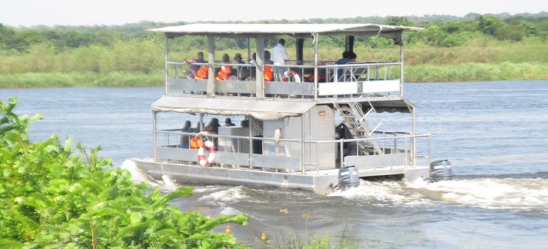
At the bottom are working fishing villages, not resorts. Boats go out at night and come in at dawn, and the beach in the early morning is where the day’s catch is sorted, smoked and argued over. Nile perch, tilapia and the small silver mukene laid out drying on racks. Anyone can arrange a ride out on a boat by asking, and the price is whatever you negotiate. Take a life jacket seriously here, because most local boats carry none and the lake turns rough quickly when the wind comes down off the escarpment.
Birding along the shoreline is strong and underrated. Papyrus fringes hold shoebill on the right day, though the reliable Ugandan sites for that bird are elsewhere. Pelicans, fish eagle, herons and a heavy passage of waders work the shallows. Sport fishing for Nile perch is run properly out of the lodge inside Kabwoya, with boats and tackle laid on.
Kabwoya and Bugoma Wildlife Tours South of Hoima
Kabwoya wildlife tours cover the small reserve that runs between the escarpment and the lake south of the city, about 87 square kilometres of open country gazetted as a wildlife reserve in the early years of this century. It shares a boundary with the Kaiso Tonya community wildlife area to the north.
Manage expectations before you go. This is not a big game destination and it never was. What lives there is Uganda kob in reasonable numbers, Jackson’s hartebeest, bushbuck, warthog, oribi, buffalo in small groups and a scatter of primates along the watercourses. Lion and elephant pass through occasionally and are not something to plan around. Birding is the stronger reason to come, with well over four hundred species recorded across the reserve and the adjoining lakeshore, including Albertine Rift specialities that birders will already have on a list.
The reserve has one established lodge on the lakeshore, and it runs the activities that make Kabwoya interesting as a stop rather than a drive through: game drives, guided walks, sport fishing, quad biking and horse riding across the open ground. Fossil hunting is offered too, and the rift sediments here genuinely do turn up material. Entry is charged per person and is modest by Ugandan standards.
Further south again lies Bugoma Central Forest Reserve, roughly four hundred square kilometres of medium altitude forest holding somewhere around six hundred chimpanzees along with black and white colobus, red tailed monkey and a long bird list. Bugoma is worth naming honestly rather than selling. Large areas of it have been cleared for sugarcane under a land title dispute that has run for years, and conservation organisations have documented both the loss of forest cover and its effect on the chimpanzee population. Habituation for tourism has been slow and access is limited. If chimpanzee tracking is the reason you are in the region, Budongo and Kibale are the places that deliver it reliably. Bugoma is a forest to understand rather than a forest to book.
Budongo Forest Birding Safaris and Chimpanzee Tracking
Budongo Forest birding safaris are the most rewarding half day within reach of Hoima, and the drive out is around an hour and a half northeast through Masindi.
Budongo covers about 825 square kilometres of mahogany forest on the escarpment above Lake Albert, the largest surviving block of its kind in the country, with something over four hundred and sixty recorded plant species. Chimpanzee tracking runs from Busingiro and Kaniyo Pabidi with habituated groups, and most parties find them, though nothing is promised. Groups move, and guides will tell you so before you set off rather than after.
The birding draw is a stretch of forest road known as the Royal Mile, and it deserves its reputation. Kingfishers of several species, Ituri batis, chocolate backed kingfisher, forest robins, illadopsis and a long list of forest interior birds that are hard to find anywhere else in Uganda. Go at first light. The road is level, the walking is easy, and the guides at Busingiro know the calls cold.
Tracking permits and forest entry are booked ahead through the forest authority or an operator, and numbers per group are limited. Long sleeves, closed shoes and repellent are the standard kit. The forest floor is damp most of the year.
Murchison Falls Safaris From the Hoima Side
A Murchison Falls safari out of Hoima is the main reason many people are in Bunyoro at all, and coming from this direction has a practical advantage worth knowing.
Hoima sits roughly two hours from the southern side of the park via Masindi and the Kichumbanyobo gate. That puts you on the south bank, which is where the top of the falls is reached on foot and where the Kaniyo Pabidi forest sits just inside the boundary. The northern grassland, with the Buligi tracks, the Rothschild’s giraffe herds and the best of the game viewing, is across the Victoria Nile at Paraa and reached by ferry.
What that means in planning terms is simple. Entering from Hoima suits an itinerary that wants the top of the falls, the launch trip upriver and a night on the south bank. If your priority is the northern game drives, allow for the ferry timetable or come at the park from Pakwach instead. Either way the boat trip to the base of the falls is the fixed point, with hippo, crocodile and good elephant sightings along the banks, and the delta run in the other direction carrying the better chance of shoebill.
Park entry is charged per person for each twenty four hours, and it is at the top of the Ugandan range. Figures are in the questions below.
Oil in the Albertine: What a Hoima Trip Actually Shows You
Every travel page about Hoima calls it the oil city and then says nothing further. Here is the factual position, reported straight, because it affects what you will see, what you will pay for a room and how the roads behave.
Commercially viable oil was confirmed in the Albertine Graben, the rift floor east of Lake Albert, in the first decade of this century. The Petroleum Authority puts the total in place at roughly 6.5 billion barrels, of which about 1.4 billion is considered technically recoverable, spread across more than twenty discoveries. The two production projects are Tilenga, north of the lake in Buliisa and inside part of Murchison Falls National Park, and Kingfisher on the southeastern shore. A heated export pipeline runs from a hub near Hoima across Tanzania to the coast at Tanga.
What has actually been built, as against announced, is the part most coverage skips.
On the ground in Hoima the visible effects are ordinary and commercial: new hotel blocks, office space, supermarkets, a lot of pickup trucks with company decals, and rents that have risen well beyond what local wages support. That last point is the one residents raise most often. Housing near the centre has been priced away from the people who lived there, and the pressure has pushed settlement outward faster than water and health services have followed. In Kabaale parish, where the refinery land was taken, families were moved and compensation disputes ran for years.
There is no visitor centre, no tour of the refinery site and no viewing platform. Do not photograph installations, checkpoints or the airport perimeter. These are treated as security sites and the people guarding them have no sense of humour about cameras. If you want to see the scale of what is happening, the drive down the Kaiso Tonya road shows you the engineering, the traffic and the new settlements without pointing a lens at anything sensitive.
Conservation groups have documented the position on the other side of this, particularly around drilling inside a national park and pipeline routing through the Lake Victoria basin. Those arguments are real and they are not settled. What is beyond argument is that Bunyoro is being rebuilt around an industry that has not yet produced a barrel for export, and Hoima is where you can watch that happen.
Hoima City Walking Tours: the Market, the Cathedrals and the Museum
A Hoima city walking tour fills a morning comfortably. The centre is small, flat and safe to walk, and almost nothing is more than fifteen minutes from the main junction.
Hoima Central Market is the anchor. Matoke, cassava, fresh fish brought up from the lake that morning, dried mukene, groundnut paste, bark cloth if you ask around, and a hardware and tailoring section that keeps the district running. Prices are quoted honestly more often than not. Kibiro salt is sold here, which is the easiest way to buy it without walking down the escarpment.
St Peter’s Cathedral at Duhaga is the Anglican seat of the Bunyoro Kitara diocese, named for the Omukama who reigned in the early colonial decades and who is buried in the district. The Catholic cathedral sits on the other side of town. Both are missionary period buildings and both are open to visitors outside services. Bunyoro’s Christian history runs deep and is bound up with the kingdom’s politics in ways a local guide will explain better than a guidebook.
The community museum and cultural centre in town holds Bunyoro material culture: drums, domestic tools, agricultural implements, textiles, photographs. It is small, the labelling is thin and the opening hours are approximate. Ask at your hotel whether it is open before making the walk. As a fallback, or as a complement, the kingdom’s own offices can sometimes arrange a cultural session with dancers and musicians, and Runyege, the Banyoro courtship dance with its distinctive leg rattles, is worth seeing performed properly rather than as a hotel floor show.
Eat Bunyoro while you are here. Fish from Lake Albert is the obvious choice and the small restaurants near the market do it better than the hotels. Otherwise the standard rotation of matoke, posho, beans, groundnut sauce and grilled goat. Two or three places in the centre have been feeding travellers for decades and will be named by anyone you ask.
Getting to Hoima and Choosing Between the Two Roads
There are two ways up from Kampala and the pages that quote a single figure are quietly picking one without telling you.
The direct road runs northwest through Nansana, Wakiso, Kakiri, Busunju, Bukomero and Kiboga, about 200 km of tarmac single carriageway the whole way. Google will tell you three and a half hours. Plan four to five, because the first 20 km out of Kampala can take an hour on its own and this is a busy freight route serving the oil sector. Heavy trucks, blind rises and overtaking are the risk. Do not drive it after dark.
The other option runs up the Gulu highway through Luweero and Nakasongola, crosses the Kafu, then turns west at the junction for Masindi and comes into Hoima from the northeast. It is roughly 70 km longer and takes an hour more. Take it anyway if Murchison Falls, Ziwa or Budongo are part of the same trip, because it puts all three on your route rather than adding a separate leg. One caution: the Kafu crossing has flooded and closed the road in exceptionally wet years, which is worth a check in the middle of the rains.
By bus, several operators run Kampala to Hoima through the day and the trip takes four to five hours. Buses leave from the Kampala terminals rather than a single station, and the fare is low enough that it is not a planning factor. Shared minibuses cover the same route with more stops and less comfort.
Going onward south to Fort Portal, the road runs through Kagadi and Kyenjojo. This used to be a genuinely rough stretch and older trip reports still describe it that way. It was upgraded and is now a good surface for most of its length, though dusty in the dry months. Allow four to five hours. Hoima to Masindi is an hour, Hoima to the lake at Kaiso is under two on the new road.
Within the city, boda boda is how everyone moves and short hops cost almost nothing. Shared taxis work the routes out to Kigorobya and Buseruka. For the sites outside town, hiring a car with a driver for the day is the sensible answer and any hotel will arrange one. Fuel is reliable in Hoima and much less so once you leave it, so fill up before heading for Kibiro or Kabwoya.
Where to Stay in Hoima and the Best Time for a Bunyoro Trip
Hoima’s accommodation is built for oil sector contractors and government visitors rather than tourists, which works in your favour. Standards are higher than the visitor numbers would suggest and there is more of it than a town this size would normally carry.
At the upper end, Kabalega Resort on the Masindi road is the established name, with gardens, a pool and the conference space that everything official uses. Hoima Buffalo, Golden Castle and Nsamo cover the middle, and there is a spread of small guesthouses around the centre where a clean room with a fan is the arrangement. Out at the lake, the lodge inside Kabwoya Wildlife Reserve is the only proper safari accommodation in the district and is a different proposition entirely: thatched cottages on the shore, activities included, a two hour drive from the city. Book ahead around Empango in June and during major kingdom events, when the town fills.
Timing is straightforward. Hoima sits in a two rains pattern, with the long rains from March into May and a second wetter spell through September, October and November. December to February is the dry stretch and the hottest, with afternoons in the low thirties on the plateau and considerably more than that down in the rift. June to August is the most comfortable window: drier, cooler, and the murram roads to Kibiro and Katasiha at their best.
The seasonal decision really turns on how much of your plan involves getting off tarmac. The city itself is fine in any month; rain here arrives as heavy afternoon storms rather than all day drizzle. The escarpment path to Kibiro, by contrast, becomes genuinely unpleasant when wet, and the descent into the rift is punishing in the December to February heat regardless of how dry it is. For Murchison Falls game viewing, the dry months from December to February concentrate animals near water and are the strongest period.
Frequently Asked Questions About Visiting Hoima
Can I just turn up at Karuziika Palace and ask to look around?
No. It is the Omukama’s working residence, security is tight and casual visitors are turned away at the gate. Requests go through the kingdom’s offices in Hoima or through an operator who already deals with the palace, and they need weeks of notice rather than days. Even then the answer depends on the Omukama’s schedule. The exception is Empango on 11 June, the coronation anniversary, when the palace grounds host public celebrations and getting in is straightforward. If seeing the regalia matters to you, plan around that date rather than hoping.
What does a couple of days in Hoima cost?
Less than most of Uganda’s tourist towns, because the market here is contractors rather than visitors. A bus seat from Kampala runs around five to ten dollars depending on the operator. Rooms at the better hotels sit roughly in the sixty to ninety dollar range with breakfast, mid range places around twenty five to forty, and simple guesthouses well under fifteen. Entry to Mparo and Katasiha is a nominal few dollars each plus a tip for the guide, and Kibiro charges a small community fee. A car with a driver for a day of sites outside the city usually lands between fifty and a hundred dollars. Rates move and small community sites set their own, so confirm before you budget.
Is Hoima safe?
Yes, with the ordinary urban cautions. Hoima has the petty theft and bag snatching of any growing Ugandan city, concentrated around the market and the transport stages, and the rapid influx of people has brought the usual pressures with it. Visitors are not targeted. The genuine risks on a trip here are road related: night driving on the Kampala road, overtaking freight traffic, and boda boda rides taken without a helmet. Near the oil installations, keep cameras away from checkpoints, the airport perimeter and anything with a fence and a guard. Malaria is present year round, so take prophylaxis and use repellent after dark.
How hard is the walk down to Kibiro?
Harder than it sounds and much harder coming back. The path is about 2 km of loose, rocky ground dropping several hundred metres, with no shade and no water source at the bottom. Descending takes around an hour for most people. The climb back out takes longer and is done in real heat, since the rift floor runs ten degrees warmer than the plateau. Anyone with knee trouble should think carefully. Go at dawn or in the late afternoon, take at least two litres of water each, wear proper shoes and accept the walking stick the guides offer. Reaching the village by boat along the lake is the alternative if the climb is not realistic.
Is Kibiro a UNESCO World Heritage Site?
Not yet, whatever you have read. Kibiro sits on Uganda’s tentative list, which is the queue of sites a country has nominated for future consideration. Plenty of travel pages state it as a full inscription and they are wrong. The distinction is not pedantry: tentative listing brings no protection, no funding and no management obligation, which is part of why the village is under pressure from lake level changes and from the wider development in the district.
What are the park entry charges if I carry on to Murchison Falls or Kabwoya?
On the most recently published wildlife authority tariff, a foreign non resident pays around forty five dollars per person for each twenty four hours at Murchison Falls, with lower bands for foreign residents and East African citizens and reduced rates for children. Kabwoya Wildlife Reserve is far cheaper at roughly ten dollars for the same category. Launch trips, ranger guided drives and vehicle entry are charged on top. Chimpanzee tracking permits in Budongo are a separate booking again. The tariff is published in cycles and the authority does not make it easy to check, so treat these as the shape of it and confirm with your operator.
Can I see the oil refinery or the new airport?
Not as an attraction. There is no visitor centre, no tour and no viewing point at either, and both are treated as secure sites where photography will get you stopped. The refinery has not actually been built in any case; the land is cleared and the engineering work continues, but there is no plant to look at. The airport’s runway and cargo terminal are finished and the passenger terminal is still going up, with no scheduled passenger services running. What you can do is drive the Kaiso Tonya road west towards the lake, which passes through the heart of the development and shows you the scale of it without pointing a camera at anything sensitive.
Is Hoima a good base for chimpanzee tracking?
Budongo, yes. It is around ninety minutes northeast through Masindi, the groups at Kaniyo Pabidi and Busingiro are properly habituated, and the Royal Mile birding nearby makes a strong full day out. Bugoma, the forest south of the city, is a different story. It holds a substantial chimpanzee population but has lost large areas to sugarcane clearance under a long running land dispute, habituation for visitors has been limited, and access is difficult. If tracking is the point of your trip, book Budongo or go on to Kibale rather than counting on Bugoma.
Which road should I take from Kampala?
The direct route through Busunju and Kiboga if Hoima is your destination: about 200 km, tarmac throughout, four to five hours realistically. The longer route up the Gulu highway and west through Masindi if Murchison Falls, Ziwa rhino tracking or Budongo are part of the same itinerary, since it strings all of them together instead of making each a detour. That way adds around 70 km and an hour. In heavy rain check the Kafu crossing before committing to it. Whichever you take, start early and be off the road before dark.
Do I need Runyoro, or will English do?
English works everywhere you are likely to go: hotels, restaurants, guides, the market. Runyoro is the first language of Bunyoro and it is closely related to Rutooro but quite separate from Luganda, so Luganda phrases picked up in Kampala will land oddly here. A greeting in Runyoro goes a long way at the tombs and in the villages. Oraire ota for good morning, webale for thank you. Guides at the cultural sites will happily teach you more than you can hold on to.
Uganda Safaris works with Ugandan operators who actually run Bunyoro, with drivers who know which road from Kampala suits your itinerary, guides with standing arrangements at Mparo and Kibiro rather than turning up cold, and the contacts needed to put a palace request in front of the right person with enough notice to work. Hoima is named on the longer western routes by way of example, among them this seven day safari through Hoima, Murchison Falls, Ziwa and Kibale.
Browse the wider western Uganda itineraries on the site and compare what each operator includes.
Then ask an operator directly for help fitting Hoima into a route that also takes in Murchison Falls, Budongo or the road south to Fort Portal.
6 Places to Visit in This Area
Individual sites within reach of here, each with its own guide. Some are written up because the name circulates and the place does not, which is worth knowing before you plan a drive around one.
Safaris That Visit Hoima
Every safari listed here that visits Hoima. Each is sold and run by an independent Ugandan tour company. This site lists them and passes on enquiries; it takes no booking and charges you nothing.
Open the full Hoima listing